Window to Chiang Mai Thailand

Window to Chiang Mai Thailand
Elephant Care & Trekking Tours
(R1192 & R1088)
 (Overnight recommended. R1192 starts on R1009 on Doi Inthanon at KM.38. Mae Chaem 22 km. The return to Chiang Mai from Mae Chaem on R1088 via Ob Luang and Hot is 156 km.)
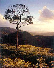
R1192 from Doi Inthanon to Mae Chaem offers fine views west, but be very careful of oncoming traffic on this narrow, twisting road!
Narrow country lanes along the valley link pretty villages to the market at Mae Chaem town. Less affected by development than the main valley of the Ping River, the area offers some of the most picturesque rural scenes near Chiang Mai. The town offers only basic accommodation; the best is near Hot.
Huay Sai Luang & Mae Pan Falls
See location at Google Maps: Huay Sai Luang & Mae Pan Falls
(KM.6 north turn down well-maintained, but steep dirt road - 3 km. 4WD)
The relatively inconvenient access means these waterfalls are less visited. The Mae Pan Falls beyond Huay Sai Luang and the forest station (take the track that climbs) are more spectacular and there are several natural pools ideal for swimming. The area gets late afternoon sun and is pleasant for walking and camping.
Mae Chaem
See location at Google Maps: Mae Chaem
The town is relatively unspoiled by development and the ways of the people are still traditional. Roads into the area have only recently been scaled. As a result the narrow valley has been isolated from mainstream development.
Mae Chaem is famous for its weaving, particularly of the sin tin chok which is a weaving technique for the decorative piece at the hem of women's tube-skirts.
Several small shops selling local women cloths may be found on the road from the market to Doi Inthanon.
Weaving villages are found at Ban Thong Fai (cross the river from the market and turn left after the bridge - 1 km.) and near Wat Yang Luang.
Tours out of the town in virtually any direction are interesting. Dirt roads lead to picturesque villages and terraced rice fields. In the hills to the west there are many Karen villages, but Hmong villages are also common, especially in the high ranges north of Doi Inthanon.
Rural Temples near Mae Chaem
Several old rural temples are located near Mae Chaem. The old viharn of Wat Pa Daet (R1088. West turn at sharp left hand bend 1 km. south of junction with R1192) contains some 19th century murals, which are well preserved in parts.
The viharn dates back to 1877. Wat Yang Luang is down a lane just to the north of the short track down to Wat Pa Daet.
Across the river from Mae Chaem market to the north, Wat Putha En has a rare wooden ubosot set on posts in a lotus pond. The temple dates back to 1868. Further along the same (unsealed) lane Wat Kong Kan (just over 7 km. from Mae Chaem) contains a large, old seated Buddha image. The dirt road that runs beyond Wat Kong Kan promises an interesting tour into remote countryside.
Mae Chaem to Hot
(68 km. south turn 2 km. from Mae Chaem) R1088 eventually climbs to a plateau passing Karen villages which depend on vegetables grown on the upland plateau. The sharp descent into the valley again offers some fine views south.
Thepanom Hot Springs
(KM.9 approximately 39 km. from Mae Chaem)
A small geyser spouts hot water, but the site is not inspiring. Keys to the huts for mineral baths are available at the building uphill to the left of the entrance gate.

Ob Luang National Park
See location at Google Maps: Ob Luang National Park
(H108 KM. 174 km. east of junction of R1088 & H108)
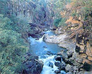
The Mae Chaem River thunders through a very narrow gorge. Footbridges across the river at the Krairaj Resort and high across the gorge 500 meters downstream make a circular walk possible. A walk up from the downstream bridge passes an ancient burial site (Land of Prehistoric Human), the remains of which are in the National Museum in Chiang Mai. Ancient drawings on rock beneath an overhang higher up are of questionable authenticity, but a fine view over the valley can be enjoyed from the rock outcrop above at Doi Pa Chang.
Sightseeing Guide
Ob Luang National Park via Mae Chaem