Window to Chiang Mai Thailand

Window to Chiang Mai Thailand
Elephant Care & Trekking Tours
(H108 & R1009)
Full Day. Round trip to summit 200 km. Regular buses to Chom Thong. Yellow minibuses from Chom Thong go to Mae Chaem and the summit)
You must start early if you want to visit Wat Phrathat Sri Chom Thong (60 km.) and go to the summit of Doi Inthanon (47 km. from Chom Thong) in one day. The road to the top passes several famous waterfalls and goes through some dramatic mountain scenery. Alternatively you can just visit a waterfall in the park and then continue south on H108 to see a cotton-weaving village before returning.
A longer scenic circular (overnight recommended) route goes via Doi Inthanon, Mae Chaem, Ob Luang National Park (44 km. from Chom Thong) and Hot. The Mae Chaem valley west of Doi Inthanon offers beautiful scenery and relatively undeveloped rural villages.
Sanpatong
See location at Google Maps: Sanpatong
(KM.24)
The Saturday morning cattle market (KM. 25 west side) is the best-known feature of this small market town. At the front of the market, tarpaulins cover stalls selling clothing and household goods, while the middle part is a huge second-hand motorcycle market. The cattle market itself is at the back. There you can see animals change hands for 6-8,000 THB and listen to forlorn calves mew pathetically for their mothers. The site of the market is next to Wat Pa Charoentham, which has large grounds occupied by a number of gaudy modern statues. A very large reclining Buddha image lies on the south side.

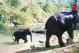
Mae Wang Elephant Camp
See location at Google Maps: Mae Wang Elephant Camp
(KM.21 on R1013 west from Sanpatong. 400 THB. for 1 hour plus ride. Longer rides negotiable & rafting available.)
This camp is less developed than those north of Chiang Mai and a Thai speaker would be helpful for communications.
Book a tour to Mae Wang Elephant Camp with Window to Chiang Mai,
or make a trek on the back of the Doi Inthanon with Buddy Tours Chiang Mai
Chom Thong
The high street is typical of northern Thai towns, and wooden buildings cluster on the back streets to the west. The town market is a good place to stock up with grilled meats, sticky rice and fruit for a picnic.
Wat Phrathat Sri Chom Thong
See location at Google Maps: Wat Phrathat Sri Chom Thong
(KM.59)
Chronicles suggest the origins of this famous temple go back as early as 749 AD, when the highly revered Phra Boromathat Chom Thong relic was found. A viharn has-been on the site since at least 1466. The current viharn was built in 1817 and is extensively decorated with wood carvings. The building contains a mondop - a chedi-like reliquary which houses the Buddha relic decorated with golden stucco. The revered Buddha images and finely carved elephant tusks around the mondop give the viharn the feeling of a museum.
On the main Buddhist holidays, the relic, which is reputed to be from the cranium of the Buddha, is brought out of the mondop for display. At the back of the mondop, past cages containing valuable Buddha images, a small room contains a Buddha bed donated by King Muang Kaew, (r.1495-1526) who probably sponsored development of the temple.
Cotton Weaving near Chomthong
See location at Google Maps: Cotton Weaving near Chomthong
(15 km. south from Chom Thong on H108)
Several cotton weaving villages lie a short distance south of Chom Thong. Mon Duang Duan (KM.65 east side) has a workshop with looms as well as a riverside restaurant. The Nang Ap Chang women's weaving group (KM.68 east side just after the cement elephant) is a little further.
Ban Rai Pai Ngam (Thai sign) - Pa Saeng Da textile museum (English sign) offers an excellent textile weaving display (KM. 68 east turn 400 m. Hours. 08:30 - 17:00. Tel: 01-5100460)
Doi Inthanon National Park
 (H108 KM.57 west turn onto R1009 - 47 km. to summit. Adults 200 THB, Children 100 THB. Keep ticket to enter at any gate and for a checkpoint at KM.38)
At 2,565 meters, the granite mass of Doi Inthanon is over 200 meters higher than anything else in Thailand and has true upper montane forest. R1009 passes waterfalls (sign posted as nam tok) and viewpoints on the route to a radar station on the summit. Facilities inside the park are limited.
Food stalls may be found at the main waterfalls and there is a canteen-style restaurant at the royal chedis. The park entrance on R1009 is at KM.8. Drop into the visitor center at KM.9 for an English brochure.
Mae Yai Falls
(R1009 KM. 1 south turn - 13 km.)
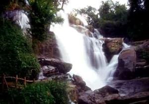
To visit these falls you must buy or show a park entry ticket at the gate located just after the road begins to climb. The falls, which drop 100 meters in a stepped cascade, are best seen in the early part of the morning.
It is possible to get to R1009 up Doi Inthanon by taking a concrete road north from the Mae Ya approach road just before it begins to climb up to the park gate. The road becomes a dirt track that skirts the hills.
 Mae Klang Falls
(R1009 KM. 7 left turn 400 m.)
These falls are very popular, especially at weekends, and there are numerous food stalls at the car park. Thais typically like to eat raw papaya salad - som tham (this is a tasty dish, but it can be very spicy indeed - try it with peanuts before tasting one with crab), grilled chicken and sticky rice. Cross over the bridge to enter the tidy gardens of the Kamphaeng San Buddhist college. You need a park ticket to take the footpath (a vehicle ticket will let you pass) to the falls. The path continues up to the visitor center and pools and the open rock beyond.
Brichinda Cave
(KM.8 Right turn - walk 1.5 kms.)
The walk to the large, partly collapsed cavern on the other side of the low ridge is clearly marked, but crossing the torrent at the bottom may be awkward if the logs have been washed away.
Wachiratarn Falls
(KM.20)
The water tumbles down a steep slope before the main drop. The falls make a good point to break the journey up the mountain. A food stall is located on the path that follows the water chute down above the falls proper.
Karen Village
(KM.23)
At KM. 23 a dirt road to the north (right) leads to the Karen village of Ban Pha Mon and a rough circular route (4WD).
Siriphum Falls
(KM.30 north turn)
A road gives access to the Siriphum Waterfalls nearby and to a rough dirt road (4WD) that connects in the uplands with R1013 from Sanpatong.
Doi Inthanon National Park Headquarters
See location at Google Maps: Doi Inthanon National Park Headquarters
(KM.31)
Bungalow accommodation is available (advance booking advised) and tents may be rented. A covered dining area contains food stalls which offer food to order till 8 PM.
The Royal Chedis
See location at Google Maps: The Royal Chedis
(KM.40 west turn - 200 m.)
The southern Napamethaneedon Chedi commemorates the 60th birthday of His Majesty the King (December 5, 1987); The Napapolphumsiri Chedi that of the Queen (August 12, 1992). The modern chedis contain stylized Buddha images and are decorated with interesting tiled murals that are worth close study. The chedis are excellent viewpoints. The restaurant at the car park (08:00 - 17:00) serves Thai food from display trays and is the best on the mountain.
The Summit of Doi Inthanon
See location at Google Maps: The Summit of Doi Inthanon
After the final steep climb, the summit of the mountain is surprisingly flat. Often shrouded in mists, the trees are covered in moss. A visitor station has a good display of information (English and Thai) about the ecology on the mountain.
The Aangka nature trail on the opposite side of the road leads to a boardwalk across a small bog with sphagnum moss. A side path leads to a shrine at a helicopter crash site.
A small chedi above the visitor center contains the remains of Chao Inthawichayanon who died in 1897, the last independent ruler of Chiang Mai before Lanna was incorporated into Siam.
See also:
Walking on Doi Inthanon Wetland Rice Cultivation
Sightseeing Guide
Chom Thong & Doi Inthanon