Window to Chiang Mai Thailand

Window to Chiang Mai Thailand
Elephant Care & Trekking Tours
In past times travelers had to follow tracks up the riverbeds and torrents, braving tigers and occasionally bandits, just to pass into the next valley.
While sealed roads now make travel easy, there still remains plenty of rugged mountainous country that may only be reached on foot or by four-wheel drive.
Touring: The Basics
The Tour Routes in this guide follow the main highways out of town before branching off. For the first few kilometers these highways are high-speed double roads lined with commercial developments. Small lanes lead away from these main highways into traditional villages and modern housing projects. Once away from the city, the highways become single roads that go through small towns and countryside before climbing out of the valley.
The roads are classified into main highways (H) and roads (R) with less volume of traffic. Rough unsealed tracks are listed as 4WD (four-wheel drive).
The mountains and hilltribes are treated separately at the end of this section. Each route is summarized at the beginning before details are listed.
Public transport
Though this guide recommends renting a vehicle, bus transport is available along the highways, and the minor routes are usually served by passenger pick ups.
These may be caught from the nearest market, or by waiting at the side of the road you wish to go up.
Doi Suthep - Doi Pui National Park
(Half to One Day. Round trip to summit 46 km. Go to market on Maninopharat Road at the Chang Phuak Gate intersection to catch a "songthaew" bus to Wat Phrathat Doi Suthep. Or go to the red minibuses on Huay Kaew Road by the front gate of Chiang Mai University. City Bus 3 terminates at the Huay Kaew waterfall.)
A trip up to Wat Phrathat Doi Suthep is a pilgrimage for Thais who visit Chiang Mai. Beyond the temple the King's mountain retreat at Phuping and the Hmong village of Ban Doi Pui (Ban Maew) also attract many tourists.
The road that snakes up the mountain has been widened as far as the royal palace to handle the increasingly heavy flow of visitors up the mountain.
The National Park offers some pleasant walking that is easy as long as you stay on the wide tracks. The upper part of the mountain will interest nature lovers. The car parks at the main sights have lots of stalls selling souvenirs, drinks and food.
Doi Suthep - Doi Pui - Sacred Mountain and National Park
 The people of Chiang Mai believe that Doi Suthep - Doi Pui (1685 m.) is the home of the guardian spirits of the city, Pu Sae and Ya Sae. To this day offerings of food are made to the spirits at various places on the mountain.
The mountain is a sacred place as well as a conservation area, so projects that threaten the forested slopes are strongly opposed.
Recent efforts to preserve the forest have included dropping water from helicopters to put out forest fires in the dry season.
The national park was established in 1981 and is home to a wealth of biodiversity. The seasonal tropical forest contains 90 different species per hectare. In addition to more than 2100 species of vascular plants so far identified (by the Herbarium at the Department of Biology at Chiang Mai University), birds (326 species), mammals (61 species including bats), reptiles (50 species), amphibians (28 species) and numerous types of butterflies make their home here.
Khru Ba Srivichai Monument and Huay Kaew Falls
See location at Google Maps: Khru Ba Srivichai Monument and Huay Kaew Falls
(Srivichai Road km. 4)
Many people in Chiang Mai pay respect with incense, candles and gold leaf to the monument dedicated to Khru Ba Srivichai, who built the road up the mountain.
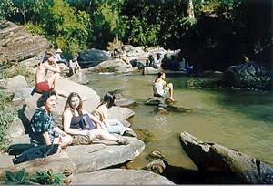
The Huay Kaew - crystal stream - cascades off the mountain in a series of waterfalls.
Monthatharn Falls
See location at Google Maps: Monthatharn Falls
(KM.5 west turn - 2 km. 4WD)
 These are the nicest falls to visit on the mountain and can be reached by a dirt road (steep and slightly rutted in one part). From the car park at Monthatharn Waterfall, a path follows the Huay Kaew torrent up.
Beginning on the south side, it crosses over to the north side at the upper falls. Climbing very steeply the path passes more cascades and pools that become less visited the higher it goes. The steep track is part of a walking route to the National Park HQ. When further walking up the right (north) side of the stream seems impractical, the path crosses over to the south side at a fallen tree.
See location at Google Maps: Wat Phrathat Doi Suthep
(KM. 14)
The car park at the base of the promontory contains restaurants and souvenir shops. These sell such things as baseball caps made from old whiskey cartons. A path from the base of the naga steps leading to the temple goes up to the National Park HQ.
National Park Headquarters
See location at Google Maps: Doi Suthep - Doi Pui National Park HeadquartersDoi Suthep - Doi Pui National Park Headquarters
See location at Google Maps: Wat Phrathat Doi Suthep
(KM.15 Tel: 248405)
The National Park Headquarters provides accommodation, maps and information.
Work at the small research station (FORRU) below the main office concerns natural forest regeneration.
A trail to Monthatharn Falls begins downwards from the bungalows about 150 meters past the park office and then follows the contour north for about 700 meters. The path passes a good example of a fully developed "strangling" fig (Ficus altissima Bl. Moraceae) before joining a dirt road from the park HQ. After a further 500 meters a sign indicates where the path begins the descent to Monthatharn.
From the sign downwards the track at times becomes steep and slippery, and may be obstructed by fallen vegetation. The path is only occasionally maintained, so it is not for those who object to a bit of scrambling (and sweating!) at times.
The entire walk to Srivichai Road may be covered in less than two hours.
 Tham Ruesi
(KM. 16)
Good trails for walking and bird-watching lead off from the road. From the small parking area, a steep, slippery path leads down to the "hermits cave" (tham ruesi), an overhang of rocks over a wide ledge.
The path continues down through evergreen forest to the road near the park HQ.
Phuping Palace
(KM. 19. Closed December 10 to mid-April/May. Check with the TAT if planning a visit near these dates as the palace may be closed. For the rest of the year the flower gardens are open to the public on Friday, Saturday and Sunday only from 8:30-11:30 AM and 1-4 PM. Entry free, but polite dress required. Sarongs and loose fitting trousers to cover lower legs may be rented for 10 THB)
The Thais hold their Majesties in great reverence and many like to visit the palace, which is used by members of the royal family as a winter retreat.
The palace itself is an elegant, modern Thai-style building of moderate size.
Visitors may go as far as the front entrance that overlooks a terraced ornamental garden.
Entry to both the terraced garden and the palace is prohibited. Visitors must stick to a few paved walkways from which they may appreciate the rose beds.
The palace is closed to the public during peak flowering when members of the royal family may be in residence.
During the rainy season there are almost no flowers at all.
Ban Doi Pui
(Ban Maew - 3.5 km. From Phuping. 4WD)
From the palace a narrow road continues up the mountain. After one kilometer the road forks. The left (south) turn goes down to Ban Doi Pui, a Hmong village. The large car park leads to a "high street" that consists solely of souvenir shops.
The village also has a pleasant terraced flower garden where opium poppy as well as other flowering plants are grown for display.
There is also a hilltribe museum. Though the main income of the village is derived from tourism, many of the men also work in fields on the mountains slopes beyond the village.
The Summit of Doi Suthep - Doi Pui
 The right turn at the road fork after Phuping Palace leads to the summits of Doi Suthep and Doi Pui (there is a fine view west after 1.4 km.). After the road drops from the first summit of Doi Suthep, a track to the right leads to San Khu, the site of a chedi. Offerings at the small spirit house emphasize the strength of local animist beliefs. Take the track downhill from the chedi for good walking and bird-watching.
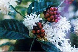
The scaled road goes to Doi Pui, but in recent years the summit has, unfortunately, been closed to visitors. A dirt road (4WD) continues down to a plantation of the "Highland Coffee Research Institute" (4.5 km.) where you can taste fresh "Coffee Arabica" from Chiang Mai (30 THB a cup) and further to the Hmong village of Chang Khian (0.5 km.).
See also:
Hiring a Vehicle Staying in National Parks Forest Types on Doi Suthep
Sightseeing Guide
Touring out of Town